
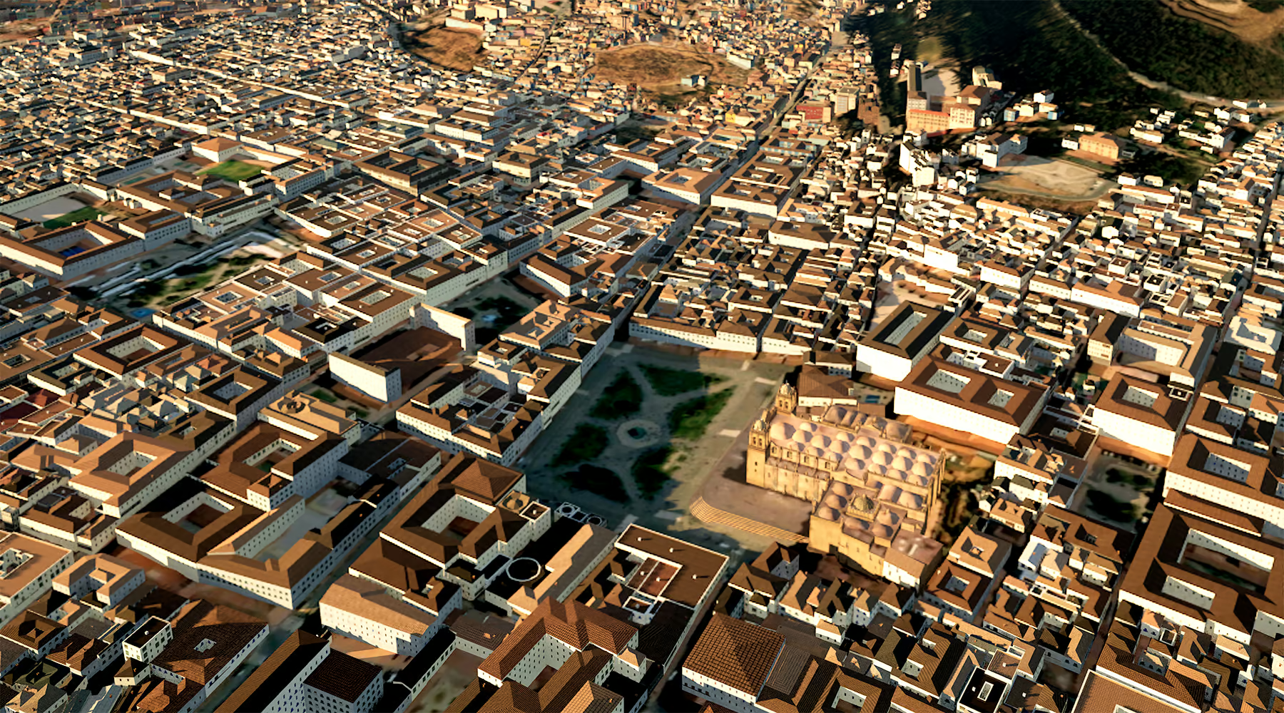
The collaboration supports the rapid generation of high-resolution terrain and object data for situational awareness and future synthetic environment applications.
Paris, France, 2 July 2026 - ST Engineering Antycip (Antycip), a European leader in advanced simulation and training solutions, is expanding access to AI-driven geospatial data solutions through its collaboration with geospatial technology specialist LuxCarta, enabling French defence organisations to rapidly generate high-resolution geospatial data for situational assessment and operational planning
Through this collaboration, Antycip will provide local access and licensing for LuxCarta’s geospatial data solutions, leveraging its established presence in France and expertise in delivering advanced military simulation solutions to defence organisations. Antycip and LuxCarta will also explore opportunities in Italy and Spain to support defence organisations in adopting AI-driven geospatial data workflows.
LuxCarta specialises in producing high-resolution 2D and 3D terrain and urban data for government, defence, telecommunications and simulation applications. Its portfolio includes the BrightEarth On-Premises solution which uses artificial intelligence to automate the extraction of geographic objects, significantly reducing the time required to produce usable geospatial data.
Gary Camps, LuxCarta’s Head of Defense business unit, said, “The technology is already being used by defence geospatial organisations to accelerate the production of mapping products required for rapid situation assessment, including for civil-military support and crisis response scenarios.”
“Access to accurate terrain and object data is critical for both operational decision-making and simulation,” said Quentin Blancheri, Major Account Manager at Antycip. “By enabling faster and more cost-effective generation of geospatial data through LuxCarta’s AI-based tools, we help customers scale up and respond more quickly to emerging security situations while developing high-quality datasets for future modelling and simulation applications.”
In addition to situational assessment and operations planning applications, Antycip and LuxCarta see strong potential to expand the use of AI-generated terrain and object data into distributed simulation, digital twin and immersive training environments.
This collaboration reflects Antycip’s broader strategy to integrate best-of-breed partner technologies within its simulation and synthetic environment ecosystem, enabling defence customers to combine operational data, visualisation and simulation capabilities within coherent and locally supported solutions.
*****
LuxCarta is a global provider of high-precision geospatial and 3D data for telecommunications, simulation, defence and digital twin applications. With more than 30 years of experience, LuxCarta delivers accurate, large-scale maps, building footprints and 3D city models that serve as the trusted geodata layer AI and intelligence platforms run on. The company supports network planning, synthetic environments and mission-critical decision making across more than 150 countries.


